

Location and uniqueness
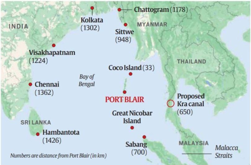
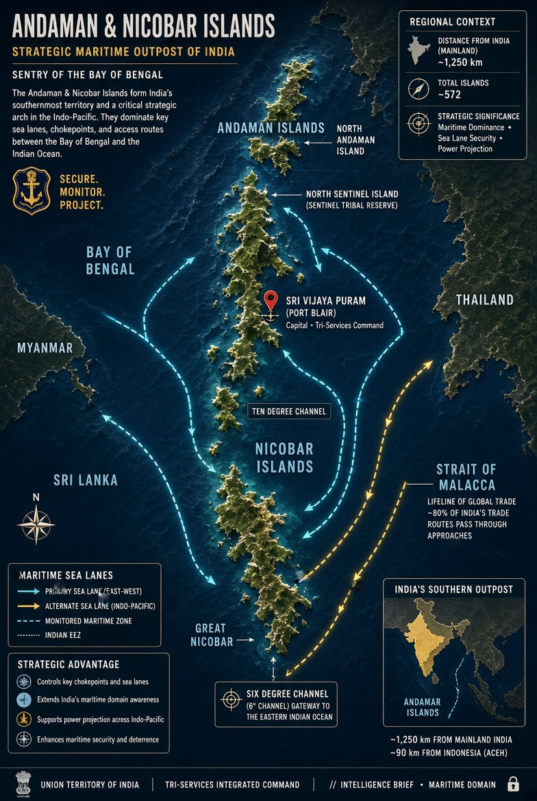
The Andaman and Nicobar (A&N) Islands, one of India’s island territories is an archipelago actually comprising 836 islands, islets, and rocky outcrops, historically generalized at 572, but officially categorised as 200 islands in the northeastern Indian Ocean, 1,282 kms from Kolkata and about 130 km southwest off the coast of Myanmar's Ayeyarwady Region. The islands, grouped into two main clusters, the northern Andaman Islands and the southern Nicobar Islands, separated by the 150 kms wide Ten-Degree Channel. Known for the only confirmed active volcano in the entire Indian subcontinent, both the islands are home to the world's largest land crab, the coconut crab (Birgus latro), which can weigh up to 4 kilograms.
Brief History
Rajendra I, ruler of southern India’s powerful Chola dynasty, built a vast empire across parts of South and Southeast Asia between the 9th and 13th centuries and used the A&N Islands as a strategic naval base to launch an expedition against the ancient Srivijaya maritime empire, then located in modern-day Indonesia.
While the Danish were the first Europeans to arrive on the islands in 1755, the islands became part of the British Raj in 1868. During the Second World War, the islands were invaded by the Empire of Japan
The Cellular Jail located in Andaman, historically known as Kala Pani (black water), stands as a stark historical testament to the cruel punitive measures employed by the British against Indian freedom fighters.
In December 1943, Netaji Subhas Chandra Bose hoisted the Indian National Flag at the site today known as Flag Point, marking an important chapter in India's independence movement.
During the 1947 partition negotiations, the Muslim League and Pakistan sought control of the islands and the departing Brits considered holding the islands for military facilities or using them as a separate homeland for the Anglo-Indian community, ultimately adhered to the Indian Independence Act, according to which the islands remained part of the Dominion of India.
On September 13, 2024, A&N’s capital, named Port Blair by the Brits, was renamed Sri Vijaya Puram, as part of Prime Minister Narendra Modi’s vision and the process to “free the nation from colonial imprints”.
The Andaman & Nicobar Command
Raised on October 8, 2001, Andaman & Nicobar Command, India’s first and only integrated tri-service theatre command, unifying the Indian Army, Navy, Air Force, and Coast Guard under a single commander, is headquartered at Sri Vijaya Puram. Its purpose was a part of addressing several crucial military, strategic, and geopolitical necessities which emanated after deliberation on the findings of the Kargil Review Committee, prepared after Indian Army’s intense operation in 1999 to dislodge many battalions of Pakistan Army’s Northern Light Infantry, which had covertly infiltrated into the strategic mountain heights of Kargil, Jammu & Kashmir.
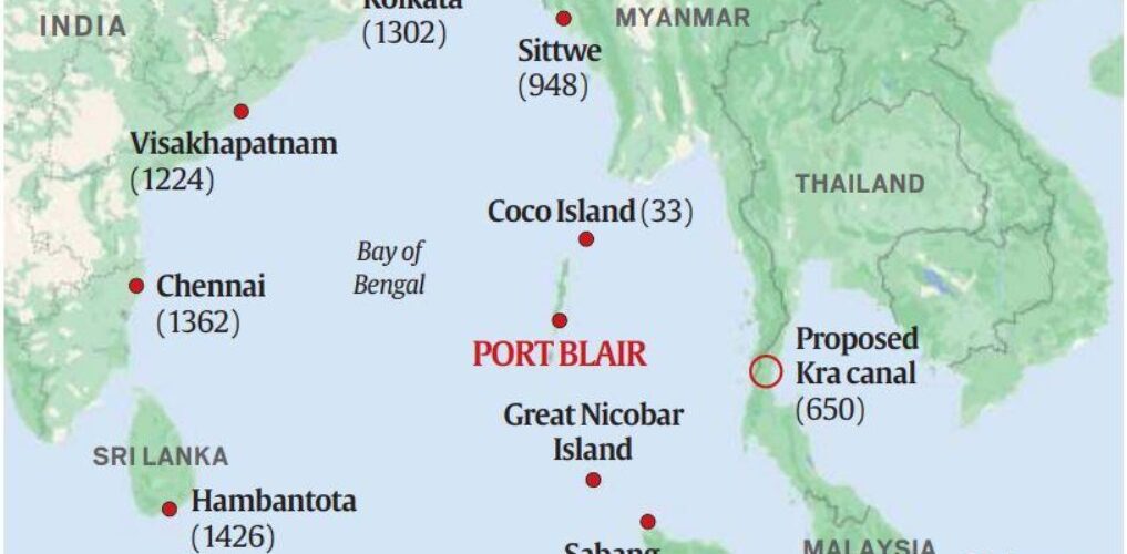
The Islands, situated at the confluence of the Bay of Bengal and the Andaman Sea, are positioned directly at the entrance of the Strait of Malacca, one of the busiest and most crucial commercial shipping and energy supply lanes in the world. ANC’s main aim is to safeguard India's strategic interests in Southeast Asia and the Strait of Malacca. It acts as India’s critical military outpost and maritime bastion in the eastern Indian Ocean region. Designed to combat non-traditional maritime threats such as piracy, gunrunning, narcotics smuggling, poaching, and illegal immigration within the region and the Indian Exclusive Economic Zone (EEZ), the ANC enables India to monitor vital trade routes, rapidly deploy military assets, and in general to project power, as required for a country facing many threats.
Establishing a strong military presence capable of monitoring foreign naval movements in the Bay of Bengal, the South China Sea, and the broader Indo-Pacific, it also strengthens India’s "Act East" policy.
ANC’s specific objectives are:
- Monitoring Critical Maritime Choke Points. The command sits directly atop vital Sea Lines of Communication (SLOCs), specifically overseeing the 10-Degree and 6-Degree channels. These channels function as global trade arteries leading into the Strait of Malacca, through which more than 94,000 merchant ships and a significant portion of the world's trade pass every year. ANC's main objective here is securing these chokepoints and ensuring freedom of navigation.
- Countering Sinocentric expansionism.
The ANC serves as a primary line of defence to track and deter foreign military presence—specifically countering China's compulsive, expansive hegemony in the seas and its "String of Pearls" strategy. From the islands, India can maintain strict maritime domain awareness, deploy assets to hunt hostile submarines, and quickly intercept any unannounced naval incursions.
- Coastal Security & Exclusive Economic Zone (EEZ) monitoring
The command is tasked with protecting the over 300,000 square kms of India’s EEZ in the region. Its routine operations are aimed at eradicating
- Maritime piracy
- Narcotics and arms smuggling
- Illegal, unreported, and unregulated (IUU) poaching/fishing.
4. Humanitarian Assistance and Regional Partnerships. Beyond combat readiness, the ANC plays a major role in Humanitarian Assistance and Disaster Relief (HADR) during natural calamities like tsunamis or cyclones. It also aims to project soft power and foster defence cooperation by conducting joint military exercises like MILAN, which in 2026 had a record participation of 74 to 75 nations’ navies and CORPAT with friendly Southeast Asian and some other nations.
The preservation and welfare of the isolated and vulnerable Negrito and Mongoloid tribal communities historically inhabiting the A&N Islands is one of India's most critical and sensitive anthropological and administrative responsibilities. The indigenous populations are broadly categorized into two distinct groups based on their origin.
According to official census data, the total tribal population in the Andaman and Nicobar Islands, categorised as Scheduled Tribes is 28,530. Except for the Nicobarese, all are designated as Particularly Vulnerable Tribal Groups (PVTGs). Their breakdown is:
Great Andamanese, a small group of 44, are originally a large confederation of distinct tribes now mostly settled on Strait Island.
Onge, 101, in number, reside primarily on Little Andaman Island and maintain a semi-nomadic hunter-gatherer lifestyle.
Jarawa, 380 in number, inhabit the western coasts of Middle and South Andaman Islands.
Sentinelese, 15 to 39 in number, inhabit North Sentinel Island and remain one of the most isolated uncontacted groups in the world.
Nicobar Islands (Mongoloid Tribes)
Nicobarese, numbering 27,168, are the most populous tribal group across the Nicobar Islands, known for practicing agriculture and horticulture.
Shompen, 229, are semi-nomadic hunter-gatherers living in the interior tropical forests of Great Nicobar Island.
While direct statutory welfare of local indigenous groups is handled by the Tribal Welfare Department of Andaman and Nicobar Administration, the Andaman Adim Janjati Vikas Samiti and traditional Tribal Councils, ANC actively participates in community outreach and national integration initiatives that benefit local youth and remote inhabitants.
Key Outreach and Support Initiatives
- The "Eyes-On, Hands-Off" Policy: Particularly applied to the Jarawa and Sentinelese, this policy focuses on protecting their territory from intruders while avoiding forced assimilation. It respects their right to self-determination.
- Tribal Reserves: Vast areas of land and surrounding waters have been legally declared as Tribal Reserves under the Protection of Aboriginal Tribes Regulation (PAT), prohibiting unauthorized entry, commercial activity, or tourism.
- Buffer Zones: Stringent buffer zones are enforced around tribal areas to prevent exploitation, commercial photography, or "human safaris" by tourists.
- Educational Tours: ANC organizes programs like "Aarohan: Dweep to Delhi," bringing meritorious students from remote island and tribal communities to the national capital for exposure and interactions with senior national leaders.
- Medical and Coastal Support: Associated forces such as the Indian Coast Guard conduct regular civic action programs, medical camps, and safety awareness drives for remote coastal and island populations.
- Infrastructure and Strategic Balance: While mega-projects like the development of Great Nicobar involve strategic military upgrades alongside civil administration plans, monitoring committees and statutory reserves are mandated to safeguard indigenous demographics such as the Shompen and Nicobarese.
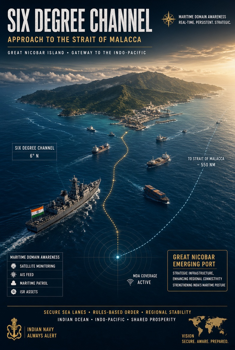
India’s Great Nicobar Project
The Great Nicobar Project is a very major venture undertaken by India to strategically strengthen its presence in the Andaman Sea and Southeast Asia and to have its own transshipment port. The mega-infrastructure project spans approximately 166.10 sq km, which covers about 10% to 18% of the total landmass of Great Nicobar Island, located at the southernmost tip of the Andaman and Nicobar archipelago. The Project is a civilian and commercial mega-infrastructure development conceived by NITI Aayog in March 2021 and while it is being executed by the Andaman and Nicobar Islands Integrated Development Corporation (ANIIDCO), it integrates dual-use military and strategic infrastructure that falls under the operational umbrella of the ANC. The project infrastructure is expected to cost ₹72,000–90,000 crore.
The project seeks to balance port-led growth with calibrated environmental safeguards and protection of indigenous communities. By combining strategic, economic, and ecological priorities, the project seeks to ensure that development in Great Nicobar is sustainable, inclusive, and aligned with national interests. The strategic significance of this initiative will be to: (a) decrease reliance on foreign transshipment ports like Colombo and Singapore and thereby a achieving a reasonable level of trade independence and (b) extend India’s geopolitical reach by positioning a powerful forward security and surveillance asset near the crucial Six-Degree Channel and Malacca Strait.
Aimed at transforming the southernmost island of India into a major global maritime, military, and economic hub, the project will require:
- International Container Transshipment Terminal (ICTT): A massive 14.2 million TEU (twenty-foot equivalent unit) capacity port at Galathea Bay designed to capture major East-West shipping traffic near the Malacca Strait. A major deep-water port infrastructure is currently being developed in the A&N Islands, most notably the deep-water project at Galathea Bay.
- Greenfield International Airport (a brand-new aviation facility built completely from scratch on previously undeveloped land). A dual-use civil and military airport featuring a large runway capable of handling wide-body aircraft.
- Power Plant: A 450 MVA hybrid gas and solar-based power station for energy self-sufficiency.
- Area Development: A massive new township and urban infrastructure covering roughly 166 square kilometers.
Two Deep-Water Port Projects being planned are:
- Galathea Bay Port, in Great Nicobar Island is a major deep-water project with a natural water depth of over 20 meters. It was officially notified as a major port of India to handle large container vessels and reduce reliance on foreign transshipment hubs and will be developed as the International Container Transshipment Port.
- Atlanta Bay, in North Andaman Advanced plans and feasibility studies are on for a new ultra-mega deep-water dry-bulk transhipment port in Diglipur to support larger regional shipping and strategic reach. It should be 18 to 24 meters (59 to 79 feet) deep to allow massive container carriers or super tankers to dock at maximum load capacity without tidal delays or expensive continuous dredging.
Three important concerns and measures
- Ecological Damage: Requires massive deforestation of pristine tropical rainforests and threatens endemic species like the giant leatherback sea turtle.
- Tribal Rights: Poses severe cultural and survival disruptions to vulnerable indigenous groups, including the Shompen and Nicobarese communities. Considering the needs of indigenous communities, the development follows a sensitive and holistic approach and aims to protect the island’s ecological resources. The plan evaluates social, cultural, and environmental impacts carefully and prioritises options that balance environmental, social, and economic goals. Tribal welfare remains central, with no displacement proposed for Shompen and Nicobarese communities and a net increase in notified tribal reserve area through re-notification measures.
- Seismic Risk: The island sits within a high-risk tectonic zone prone to earthquakes and tsunamis. To mitigate seismic and tsunami risks for the Great Nicobar Infrastructure Project (GNIP), proposed engineering and ground-stabilization solutions include deep steel and concrete piling anchored directly to volcanic bedrock, soil compaction, stone columns, vertical drains, and concrete grouting to manage liquefaction-prone geology. Galathea Bay transshipment terminal and township strips away the island's natural buffer against tsunamis and coastal erosion.
Government plans to compensate for deforestation and protect wildlife for the Great Nicobar Project through compensatory afforestation and targeted conservation plans, though these measures face strong criticism from environmental experts. Reportedly, officials have stated that the primary nesting beaches for the Giant Leatherback Sea Turtle on the western flank of the island will remain unaltered, and a research unit from the Wildlife Institute of India has been established.
The author, a strategic affairs analyst and former Defence Ministry and Indian Army spokesperson, can be contacted at wordsword02@gmail.com
More on related topics:
India develops Agalega and Minicoy Islands: https://www.thestrategicperspective.org/india-develops-agalega-and-minicoy-islands/
China’s Water Threats, India’s Malacca Leverage and Growing Indo-Pacific Contestation: https://www.thestrategicperspective.org/chinas-water-threats-indias-malacca-leverage-and-growing-indo-pacific-contestation/
Defending India’s vast maritime underwater domain: https://www.thestrategicperspective.org/defending-indias-vast-maritime-underwater-domain/
The West Asia War: Its Perspectives & Lessons for India (part 3/3): https://www.thestrategicperspective.org/the-west-asia-war-its-perspectives-and-lessons-for-india-part-3-3/